Skip to content

ISLE OF WIGHT  ·  SOUTH COAST  ·  NATIONAL BY ARRANGEMENT

LAM Geospatial.

Stop paying for guesswork.

Earthworks and stockpile volumes, progress against programme, roof and building condition, coastline and estate change, existing conditions to design from — measured from the air, and handed over as the number, the drawing, or a digital twin your team keeps measuring from long after we have left site.

Survey data for the people who have to defend a number, and aerial media for the people who have to sell something. Most clients need both, and one flight produces them.

  • Haulage booked once
  • Coast measured, not described
  • Ground you can design from
  • Stock that audits
  • Evidence a funder accepts
  • Fill kept on site
  • Claims settled on evidence
  • Site stays open
  • A twin you keep measuring from

Twelve months’ hosting, in the price. No seat to buy, no account to create — send a report to a client, an insurer or a planning officer and it opens.

Twenty minutes, in person or on a call — we open one of our own surveys and you decide whether it is worth paying for.

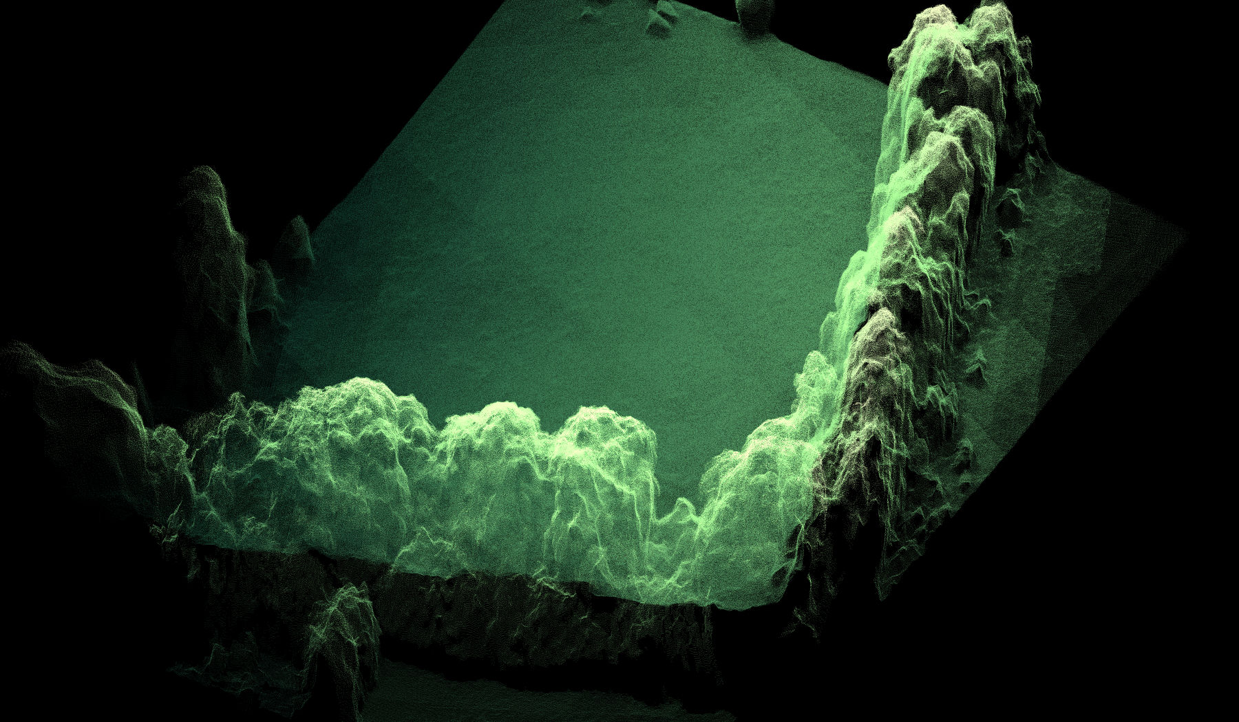
Live point cloud — 2,400,000150,000 points from our own survey, graded for screen

Who we work with

Which of these is you?

The same four services answer very different briefs depending on who is asking. Start from the one that sounds like your week — each goes straight to what it is usually costing you now.

1 — The problem

Eight decisions made on a number nobody measured.

Earth, stock, progress, condition, movement, liability, the coast, and the drawing you design from. If the figure came off a drawing, a pace-out or an experienced eye, it is costing somebody. The rates below are current UK market figures, not ours — check them against your own last job.

+25%

Earth you are paying to move

Excavated clay bulks by around a quarter as it leaves the ground, so haulage ordered off a drawing is short before the first lorry arrives — at £310–£360 a grab load. And exporting 10,000 m³ of surplus runs £150,000 to £250,000 before you buy a load of replacement fill, most of which designs out against ground that has actually been measured.

>1 m a year

Coast that is moving under your asset

Cliff retreat along parts of the Island’s south coast runs at over a metre a year, with century-scale records above two. Quay walls, revetments, groynes, slipways and pontoons are still inspected on foot, at low water, in whatever weather the tide gives you. Flown twice on the same control, retreat is a measured distance and storm damage is a dated record — and dredged arisings, once landed, are a volume somebody is invoicing you for. What is under water needs sonar, not a camera, and we will tell you so.

Invalid

The drawing you are designing from

Title plans and Ordnance Survey extracts used in place of a measured survey are among the most common reasons an application fails validation — and an invalid application does not start the statutory clock, so the programme slips before it begins. Being sent back for a topographic survey after submission costs the redesign as well as the delay. Surveyed once, properly, you design off measured ground and the drawing goes in with the application.

No scaffold

Condition you are setting a budget against

Roofs, elevations, structures and hard standing across an estate, recorded without a tower, a MEWP or a closed access route. Planned maintenance stops being a rolling guess about which building is worst and becomes a list with evidence behind each line.

1–3%

A 10% stock error is a write-off

Manual stockpile measurement carries 5–10% error and in practice often 10–20%. Aerial survey with RTK correction measures to 1–3%, from the same baseline every month — which is what makes the trend defensible to an auditor rather than an opinion.

64%

Progress you are being invoiced for

That is the share of UK construction firms over fifty staff already flying their sites. A monthly survey shows what is actually built against what was claimed, and against the design model — so a discrepancy is a conversation rather than rework.

Repeatable

Ground that is moving

Cliff retreat, slope movement, landfill void, standing water and failing drainage. Describing it is not a figure anyone can plan against. Flown twice on the same basis, the difference is a measured volume and a measured distance — which is what a trustee, an insurer or a regulator asks for.

£125k–£500k

The claim you are about to argue

That is the usual value band for a UK construction adjudication. Quantities are routinely re-measured, so every valuation is a chance to disagree. One dated surface with the control recorded, that both sides can open, settles a question before it becomes a claim.

2 — The evidence

A real survey, and what it took.

Not a case study written after the fact. These are the figures the processing report produced, from our own flight.

12,446,383
measured points
1.85 cm
ground sampling distance
6.5 ha
covered in one flight
4m 20s
in the air

Those are the actual numbers from our own survey of 23 September 2026 — the flight behind this section and turning at the top of the page. Five ground control targets were laid and surveyed with an Emlid Reach RS4, with a sixth point held back as an independent check.

For comparison, traditional topographic survey runs £350–£1,200 a day on site plus £350–£650 a day processing, with weather routinely adding three to five days. The site stayed open and working while we flew it.

Five answers most quotes leave out.

Anybody can fly a drone over a field. These five decide whether the number you get back will survive being challenged — and they are where the real difference in price sits. We put them in writing before you ask.

Every job

Ground control, not just a drone

Targets laid and surveyed with an Emlid Reach RS4, plus an independent check point, on every survey. Measured that way, our own test flight came back better than 60 mm horizontally — and the working is published, not just the number. Accuracy comes from the method, not the aircraft — so ask what control was used.

12 months

Hosting is in the price

Your data stays live for a year, extended by arrangement. Reports open for whoever you send them to — a client, an insurer, a planning officer — with no account to create.

£0

No seat for your team to buy

Survey data is commonly handed over on a platform the client then subscribes to, at roughly £3,000 a year per seat. On a five-person team that costs more than the survey. You are never asked for it.

Next working day

How fast you get it back

Traditional topographic survey means a team on site for days, then processing, with weather adding three to five more — and survey firms that publish a turnaround at all quote three to seven working days. Our last survey was four minutes twenty seconds in the air over 6.5 hectares, flown without closing the site, with the deliverables back the next working day. Larger or multi‑site jobs are agreed up front rather than promised blind. Ask anyone else how many site days they are quoting you for.

No ferry

Already on the Island

Every supplier coming from the mainland crosses the Solent to reach you — a booked crossing, a travel day, and a weather window committed to days in advance. We are in East Cowes. We watch the forecast and fly the gap in it, with no crossing to pay for and nothing on the invoice for getting here. It is also what makes a repeat visit affordable: on a monthly stockpile or a progress record, the twelfth flight costs what the first one did.

See it before you buy it

Give us twenty minutes and we will open a real survey.

Not a slide deck and not a video. We share our screen, or come to you, and open one of our own completed surveys — real ground, real control, real measurements. You see what a survey actually produces: a section across the site, levels, distances, areas and volumes, one month set against another. Ask us anything as we go. Then you can decide whether any of it is worth paying for.

  • Twenty minutes. Long enough to see it work, short enough to fit in a morning.
  • In person or on a call. Anywhere on the Island, or a screen share wherever you are.
  • Then we talk about yours. Once you have seen what the data does, we work out what a survey of your site would actually answer.
  • No obligation. We would rather you saw it working than took our word for it.

3 — How we solve it

Four ways to put a number on it.

One flight, four kinds of answer. Which you need depends on the question — a volume, a level, a condition or a picture. We set the flight plan to the deliverable, not the other way round.

Carisbrooke Castle captured from the air — the kind of complex structure a photogrammetric survey resolves in a single flight

Photogrammetry & 3D Modelling

High-overlap capture processed into point clouds, meshes and digital twins — including volumetric measurement for stockpiles, cut/fill and earthworks quantities.

POINT CLOUDS · VOLUMETRICS · MESH/OBJ · DIGITAL TWINS

View photogrammetry & 3D →
Digital surface model of a surveyed site, shaded by elevation

Aerial Surveying & Mapping

Topographic survey, orthomosaic mapping and site-progress capture for construction, land and coastal monitoring projects.

ORTHOMOSAIC · VOLUMETRICS · OSGB36 / BNG

View surveying & mapping →
Coastal rooftops photographed from above

Roof Inspection

Every roof plane captured close-range from the air, plus a measurable 3D model of the roof — no scaffolding, no ladders, and nothing for your roofer to install to open it.

RGB STILLS · MEASURABLE 3D MODEL · NO ACCESS EQUIPMENT

View roof inspection →
A festival arena lit at night, shot from the air

Aerial Photography, Videography & Event Coverage

Corporate events, festivals, property launches and marketing shot from the air — graded stills and edited video, delivered ready to publish. Recent work includes Strings Festival at The Woodland Venue, Robin Hill.

4K/10-BIT · RAW STILLS · SUNRISE/GOLDEN HOUR

View event coverage →

Not sure which of these answers your question? See the eight briefs we are usually asked for, and what each one is paying for now →

4 — What it costs

Priced on the outcome, not the hours.

Starting points for the five ways clients buy. What you are paying for is what you end up holding — every job quoted fixed once we know the site and what the output has to do.

Site Survey & Photogrammetry

From£1,950 / project+ VAT

A site you can measure, argue from and build decisions on. For scale: our own survey covered 6.5 hectares in a single flight, with ground control laid and an independent check point held back.

  • A volume you can invoice against — stockpiles, cut and fill, quantities
  • Levels, distances and cross-sections taken whenever you need them, without a second visit
  • Figures that survive challenge: ground control and independent check points, documented
  • Opened by anyone you send it to — your team, your client, your contractor, your insurer, a planning officer — with no login to buy and no seat to licence
  • Hosted by us for twelve months as part of the price, extended by arrangement — private by default, shared only with the people you name, and deleted on request. Seats on the common survey platforms are sold to the client at roughly £3,000 a year each; you are never asked for that
  • Every survey file alongside it, in the format your engineers already work in — DWG and DXF drawings, GeoTIFF orthomosaics and elevation models, LAS/LAZ point clouds, OBJ meshes and PDF reports

A MEASURABLE DATASET, NOT JUST IMAGERY

Per asset

Digital Twin

From£750 / asset+ VAT

A measurable replica of a building or asset, kept live so your team can go back to it.

  • A dimensionally accurate 3D replica built from ground-controlled capture — a record you measure from, not an animation
  • Heights, elevations, areas and distances taken off it later, without going back to site or up a ladder
  • Hosted live for twelve months, extended by arrangement, so it stays a working reference instead of a folder nobody opens
  • Re-flown whenever you want the record brought up to date, and the two versions compared
  • Built for asset and condition records, facilities management, heritage and listed buildings, insurance evidence and planning
  • Priced per asset, with further assets captured on the same visit from £475 each

A RECORD THAT STAYS LIVE

Roof Inspection

From£295 / property+ VAT

Evidence to price a repair from, without scaffold or a ladder.

  • Every roof plane photographed close-range, including valleys, ridges and junctions
  • A measurable 3D model with every plane numbered, so a roofer quotes from evidence
  • Shareable with an insurer, tenant, managing agent or roofer — nothing for them to install
  • No scaffold hire, no access equipment, nobody working at height
  • A dated record of the roof, useful later for claims and dilapidations

SEE ROOF INSPECTION →

Event & Aerial Media

From£295+ VAT

Finished media you can publish, not rushes you have to fix.

  • From £295 — one subject delivered: a building, a site, a launch, graded and ready to post
  • From £495 — an occasion covered: the moments that matter as finished stills, plus a short edit
  • From £895 — the whole story: full programme, plus a highlights film to run afterwards
  • Each tier is scoped to the coverage it needs, not to a number of hours on site
  • Flown under CAA PDRA01 and A2 CofC, so we can work close to the action

SEE FULL EVENT TIERS →

Trade & sub-contract

Pilot & Aircraft Hire

From£450 / day+ VAT

The one thing we do sell by the day — because here you are buying flight capability, and the outcome is yours to produce.

  • Qualified remote pilot and enterprise aircraft on your project, under your direction
  • Capture only — you take the raw data and process it yourself
  • No ground control, processing or deliverables included
  • For agencies, production companies and survey firms needing accredited flight capability

ADD PROCESSING & GROUND CONTROL ON REQUEST

Prices exclude VAT, which is how survey work is normally quoted — so you can set ours against anyone else’s like for like. If you are VAT registered you reclaim it, and the real cost to you is the figure shown.

Processing and twelve months’ hosting sit inside that figure, not billed afterwards. And what you get back is not a folder of files waiting for software to open it — it is the survey itself, live. Take a section anywhere across the site, check a level, measure a distance, an area or a volume, set this month against last month. Then send it to a client, an insurer or a planning officer, who opens it in a browser with nothing to install, no GIS or CAD licence, and no seat to buy. That is the part most quotes leave until after you have signed.

What moves the price

Site size and complexity, the deliverables you need, how much ground control the accuracy requires, and whether the work needs repeating over time for progress monitoring. Island work carries no travel charge at all — we are already here. Mainland and South Coast projects carry a £750 minimum to cover the Solent crossing. The line between a digital twin and a full site survey is what the output has to do: a twin is a record of an asset you measure from and return to, while a site survey adds volumetrics, contours, DEM/DTM and CAD exports across the whole site. Several structures on one site are quoted together rather than separately, because the control network and the visit are established once and the second building costs far less than the first. What does not move it is how long we happen to be standing in the field — a survey that takes twenty minutes to fly is worth what the figures are worth, not what twenty minutes is worth. Tell us the site and what the output has to do, and you'll get a fixed quote rather than a range.

Get in touch

Request a quote.

Tell us about the site and what the output has to do. You get a fixed price rather than a range, usually within one to two working days — no obligation, and no pressure to book a flight. Or just ask for a demonstration — twenty minutes, and we open a real survey for you before anybody talks about money.

Send us the details

Site location, roughly what you need surveying or shooting, and when. We'll come back with availability and a fixed price, usually within one to two working days.

Loads here on the page. We hold it back until you ask because the form sets a cookie when it opens.

Prefer not to fill in a form at all? Call, WhatsApp or email us — details on the right.